


Geodetic Surveyors
Measure large areas of the Earth's surface using satellite observations, global navigation satellite systems (GNSS), light detection and ranging (LIDAR), or related sources. Sample of reported job titles: Geodetic Advisor, Professor, Survey Director
Geodetic Surveyors
Daily tasks/Routine activities
1. Analyze control or survey data to ensure adherence to project specifications or land survey standards.
2. Calculate the exact horizontal and vertical position of points on the earth's surface.
3. Verify the mathematical correctness of newly collected survey data.
4. Plan or direct the work of geodetic surveying staff, providing technical consultation as needed.
5. Assess the quality of control data to determine the need for additional survey data for engineering, construction, or other projects.
6. Maintain databases of geodetic and related information including coordinate, descriptive, or quality assurance data.
7. Conduct surveys to determine exact positions, measurement of points, elevations, lines, areas, volumes, contours, or other features of land surfaces.
8. Compute horizontal and vertical coordinates of control networks, using direct leveling or other geodetic survey techniques such as triangulation, trilateration, and traversing to establish features of the earth's surface.
9. Request additional survey data when field collection errors occur or engineering surveying specifications are not maintained.
10. Read current literature, talk with colleagues, continue education, or participate in professional organizations or conferences to keep abreast of developments in technology, equipment, or systems
11. Compute, retrace, or adjust existing surveys of features such as highway alignments, property boundaries, utilities, control and other surveys to match the ground elevation-dependent grids, geodetic grids, or property boundaries and to ensure accuracy and continuity of data used in engineering, surveying, or construction projects.
12. Prepare progress or technical reports.
Key knowledge areas
The following key knowledge areas help aGeodetic Surveyors execute his duties better.
Mathematics — Knowledge of arithmetic, algebra, geometry, calculus, statistics, and their applications.
Computers and Electronics — Knowledge of circuit boards, processors, chips, electronic equipment, and computer hardware and software, including applications and programming.
Engineering and Technology — Knowledge of the practical application of engineering science and technology. This includes applying principles, techniques, procedures, and equipment to the design and production of various goods and services.
English Language — Knowledge of the structure and content of the English language including the meaning and spelling of words, rules of composition, and grammar.
Geography — Knowledge of principles and methods for describing the features of land, sea, and air masses, including their physical characteristics, locations, interrelationships, and distribution of plant, animal, and human life.
Skills
The following skills aid a .Geodetic Surveyors carry out his/her duties with ease ;.
Mathematics — Using mathematics to solve problems.
Critical Thinking — Using logic and reasoning to identify the strengths and weaknesses of alternative solutions, conclusions or approaches to problems.
Reading Comprehension — Understanding written sentences and paragraphs in work related documents.
Active Listening — Giving full attention to what other people are saying, taking time to understand the points being made, asking questions as appropriate, and not interrupting at inappropriate times.
Complex Problem Solving — Identifying complex problems and reviewing related information to develop and evaluate options and implement solutions.
Abilities
Mathematical Reasoning — The ability to choose the right mathematical methods or formulas to solve a problem.
Deductive Reasoning — The ability to apply general rules to specific problems to produce answers that make sense.
Information Ordering — The ability to arrange things or actions in a certain order or pattern according to a specific rule or set of rules (e.g., patterns of numbers, letters, words, pictures, mathematical operations).
Flexibility of Closure — The ability to identify or detect a known pattern (a figure, object, word, or sound) that is hidden in other distracting material.
Inductive Reasoning — The ability to combine pieces of information to form general rules or conclusions (includes finding a relationship among seemingly unrelated events).
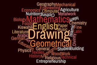
Some of the courses that prepare students for this career
Watch and Listen what the practioneers in your field are saying